Today started well as the Pennine Way wound between walls on a flower lined path, overhung with hawthorn blossom. Then the climbing started. A long pull up a track then a footpath. As I passed the 500 metre contour I entered the clouds. Soon visibility was down to 10 metres. I was glad of my GPS as in places today the path was not visible on the ground, and signs were few, although a few large cairns had been constructed. Knock Fell was the first mountain but the next one, Great Dun Fell, was of greater interest as there were a few radar domes and aerials on the top for air traffic control. Two cyclists were inside the fence that surrounded the installation, I am sure they should not have been there. According to Wikipedia the summit is in cloud for two thirds of the time, so it was unsurprising that I found it in that state today. Little Dun Fell followed and then the highest summit on the Pennines, Cross Fell. I briefly stopped at the sheltered benches at the top with another walker but there was little to keep me.

Climbing down from Cross Fell I dropped below the clouds. As I walked along the track, clouds blew across me and raced over the open moors which extended far into the distance.

Walking down to the village of Garrigill took a long time, longer than I had thought or hoped. I passed Greg's hut, one of the few bothies on the Pennine Way, there was not much in it last time I visited so I just kept going. Occasional cyclists and ramblers said hello as we briefly came within speaking distance. Heaps of rocks, collapsed walls of small buildings and a mine shaft, filled with rubbish, attested to the former mining operations. On the ground I spotted small crystals of purply fluorite by the spoil heaps. A few lapwings were excited by my passing.
Garrigill was a sweet village of stone built houses around a triangular green. I had hoped for a tea shop, but there was none and the George and Dragon pub did not look like it would ever open again (although bonus points for the public toilets). For the final stretch into Alston the path followed the River South Tyne as it splashed over ledges of rock. Initially there were meadows and paths through many types of flower. Later I crossed fields closely observed by sheep and cows.

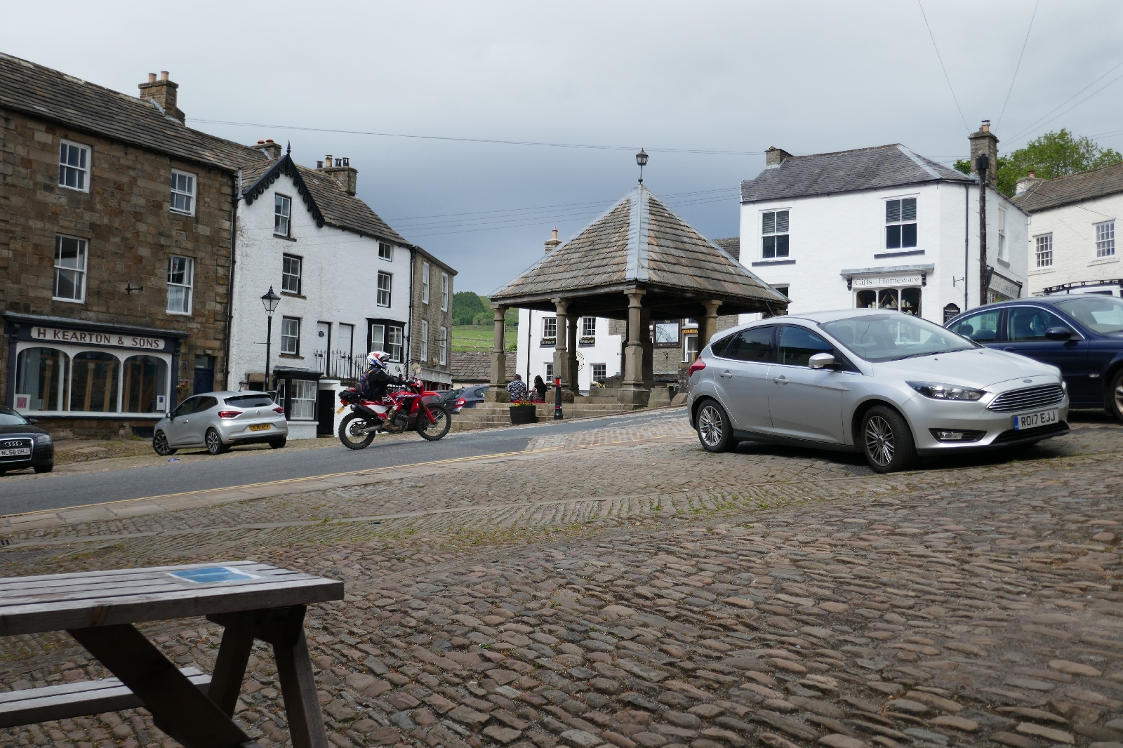
Reaching Alston village I quickly found a tea shop and bought a coffee and muffin just before it closed, enjoying them at a table outside watching motorbikes race through the square. Now I am in the Cumberland hotel, one of the many pubs in Alston. Other tables are occupied by cyclists doing their version of the coast to coast, a couple I am sure I passed on the Pennine Way and a table with two couples. One of these couples dominated the conversation with husband and wife both trying to lead the narrative on subjects as diverse as the Aberdeen cruise ship harbour, relatives in Texas, and Labour party leaders. As you can surmise they were not especially quiet...


No comments:
Post a Comment