Wednesday, June 30, 2021

Tyndrum to Glencoe: LEJoG Day 57

A long walk but a pleasant one through typical highland landscapes.

Waking up I found the remains of many midges blackening the outer surface of my inner tent. Maybe they had waited all night in the hope I would emerge, and maybe lacking access to my juicy flesh they had run out of energy and died, becoming stuck in the condensation that collects on the inside of my tent on still nights. However in the relentless war on me they had been replaced by legions more, circling outside my inner tent, waiting for me to show some bare flesh. Before exiting I pulled on my clothes, dressed my blisters and packed away as much as possible. Putting on my "Micro head net" I made a dash for the toilets. It is depressing that after washing you then have to cover your exposed flesh (and around your ankles) with insect repellent but it had to be done before I could take my tent down and complete my packing. A man was walking to the toilets with his bare chest on display, was he immune or did the midges just prefer me?

Off by 7:00 am, I was pleased a convenience store was open where I bought a coffee and bridie (a sort of pasty). The lady serving assured me the midges were everywhere. The first 11 kilometres was over a low pass obscured by low cloud and then up a valley to Bridge of Orchy, a route shared with the main road and railway. I watched the Caledonian Sleeper go by on its way to Fort William. As the paths were good I was soon in Bridge of Orchy, a small settlement with a hotel where I had an egg and black pudding roll for a second breakfast during which time the clouds lifted and the sun came out.

Hillside views by Loch Tulla as clouds clear.

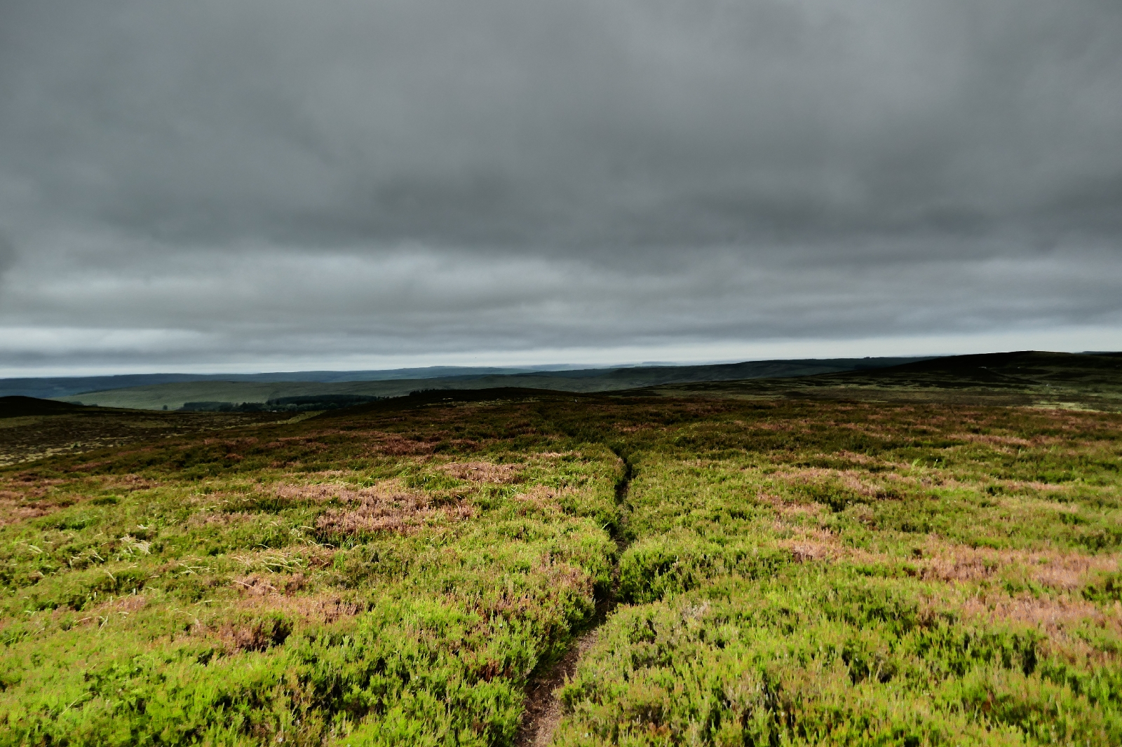
After crossing the bridge that presumably gives the place its name, I left the main road and railway behind, glad to loose the sound of traffic that had frequently accompanied me on the West Highland Way so far. I climbed through trees and foxgloves to the moorland and the top of a hill. From the top I looked down on Loch Tulla, which I mistakenly told a couple was Loch Sul. However I did take of photo for them as they hugged each other. Behind them the mountains rose up, a line of clouds strung out below their summits, adding to their beauty and making the summits look higher. Descending I soon began another long climb, a gentle one on a road built long ago by Thomas Telford, now a track for hikers. It led me through moors of grass, heather and bog myrtle. There were several false summits that I, and a well separated line of other hikers were crossing. Eventually the track reached the top of a promontory with the flat area of Rannoch Moor with its many lochs to the right.

Old road into Rannoch Moor.

Seeing a sign for a café 200 metres away at the Glencoe Mountain Resort, of course I could not resist making a detour and was soon enjoying a Coke with a cheese and tomato roll. Although the resort was open using a number of temporary looking cabins, the place looked in the process of construction. Primarily a ski resort at the bottom of a chair lift, the place had existed for many decades, but maybe they were rebuilding and expanding into mountain biking and other activities. I could have stayed at one of their "hobbit houses", a trendy name for small wooden cabins, however I wanted to cover a few more miles so that I could easily reach Fort William tomorrow where I could avoid the midges for a few nights. So with tired knees I walked down to the Kingshouse hotel (filling my water bottle at a tap kindly provided there) and continued into Glencoe, determinedly ignoring the no doubt refreshing glasses of cool, amber beer catching the sun, that people were drinking outside the hotel bar. 

Looking down Glencoe.

After a walking down the vast, glacially formed valley of Glencoe for a while, passing and being passed by other walkers, I began a long climb up what is known as the Devil's Staircase. On the final zigzag section I repassed a father and son who had passed me earlier. The father said "well done" which I thought was kind. They soon overtook me again as I stopped for a photo of the impressively large mountains on the other side of Glencoe. 

I am now camped on the ridge at the top, a little way up from the path, on a flat area of damp mossy grass among outcrops of rock. Outcrops convenient for sitting on, eating my tea while the condensation left from this morning when I packed up the wet tent, dries in the late afternoon light. Up this high it is a little cooler, there are fewer midges and an intermittent zephyr, but best of all is the panorama of mountains on both sides of the ridge. The sun is casting shadows as the earth slowly spins me away from its glare into evening, accentuating the beauty of the creviced rocks. Wild camping in the Highlands at its best.

Camping above Glencoe.

Tuesday, June 29, 2021

Inversnaid to Tyndrum: LEJoG Day 56

After more slow walking over rocks and tree roots I left Loch Lomond behind me, enjoyed breakfast at Beinglas campsite and followed a good path to Tyndrum.

Waking at 5:30 am I needed a pee. In my sleepiness I forgot that a cloud of midges would be waiting for me, and as I stood there in my underpants my legs were viciously attacked. Unfortunately some things cannot be rushed and I suffered for my lack of forethought. Leaving the tent later I prepared by wearing my trousers and long sleeved shirt, by liberally applying insect repellent to my hands and by wearing a mosquito net on my head. I had bought the head net some years before and while it might have been effective against mosquitoes the mesh was too large to prevent a sustained midge attack. Pulling the tent down and packing at speed I was soon on my way. By walking I could keep ahead of the midges as I climbed over rocks, wooden bridges, up a ladder and across streams. There were a few more wild campers on the loch's shores, still asleep as I went by, or poking their head out, hair unbrushed. After meadows, trees and a bothy (where a few people stayed) I reached the sanctuary of the Beinglas campsite.

Early morning at the north end of Loch Lomond.

What joy! Toilets, coffee and a cooked breakfast. I asked for a large coffee, so the man serving gave me two mugs! Almost immediately on drinking a little a headache brought on by caffeine withdrawal disappeared. There were a few people in the campsite café and I was to see them and others during the day as I passed them as they rested or they passed me as I took a photo. Many were using baggage transfer services. The path mainly followed General Wade's military road, built to move troops quickly if the Highlanders were revolting, so the surface was good as it went through fields and forestry. I admired a pink flower that my PlantNet App decided was a heath spotted-orchid. I admired the sunlight reflecting off the mica in the rocks of schist on the road, like pieces of ruckled, sequined cloth. I pointed them out to a passing hiker but sometimes long distance walkers seem more interested in covering the ground than what is on it or around them.

View from the West Highland Way.

Approaching Tyndrum.

With the sun oppressively hot, my thermometer reading 33 degrees centigrade, I was glad that there was a shop selling Coke and Ice Cream at the Wigwam campsite a few kilometres before Tyndrum.
At Tyndrum the campsite owner grumbled that I had not pre-booked as due to Covid restrictions tent numbers were limited. However there was room for me and I am now pitched, showered and trying out the "Micro headnet" that I bought at Beinglas farm. It claims to keep out midges, and the fine mesh seems to work as I can see them crawling on the outside, but it touches my nose and other points giving at least the sensation of insects on my skin, so it is still on probation. I walked into Tyndrum, there is not much in this settlement; a hotel, some B&B's, cafés and shops for visitors, including the "Green Welly" shop, in which I could not see any wellies, green or otherwise. I repaired to TJ's Diner to listen to Elvis while eating a burger.

Monday, June 28, 2021

Drymen to Inversnaid: LEJoG Day 55

Today I was in true highland scenery. After climbing over Conic Hill I walked up the bony banks of Loch Lomond, surrounded by high mountains. 


I made an early start, crossing dashing brooks, cascading down the hillside, and climbing up the side of Conic Hill, scattering sheep in front of me. My reward for the ascent were beautiful views over Loch Lomond, silver under blue skies with scraps of high cloud, the blue mountains of the highlands in the background, getting progressively fainter the further they were away. The West Highland Way does not go quite to the top of Conic Hill before descending into the collection of buildings at Balmaha. At 8:00 am it was too early for the National Park Visitor Centre to be open but some angels were just openning the nearby coffee shop and village store when I arrived. I had a much appreciated orange juice, coffee, banana and sausage bap which set me up for a taxing trek beside Loch Lomond.

The walk was more difficult than one might imagine. Due to promontories and the steep sides of the valley the rocky path had frequent climbs and descents. Nevertheless it was made enjoyable thanks both to the views across the water of the loch, and the green woodland that lies on the valley side. The latter was a mixture of oak, birch, rowan and pine, with an understorey of bracken and other ferns. Managed in a "natural" way, rather than cutting down trees for commercial use they seemed to be left to grow as much as they wanted and then on falling over, maybe on some stormy night, were left to rot and enrich the environment. Old, collapsed walls from some earlier existence were coated in moss with ferns growing from crevices, melting into the general greenness. Active measures were being taken in some places to encourage a mixed woodland of native species, for example by destroying any rhododendron bushes introduced from other countries. Catching my eye were two red squirrels, one chasing the other up a tree.

Loch Lomond on a particularly clear day.

Woodland beside the loch.

There were a few car parks, campsites and buildings, a Youth Hostel at Rowardennan, a hotel at Inversnaid. Although campsites were nominally full, one indicated it was open for backpackers. However I had a plan in my head and kept on up the side of the loch. The latter parts of the path were particularly narrow and onerous, climbing up and down over boulders, although in places steps had been constructed to assist and wooden bridges spanned cascades of water, tumbling, splashing down over rocks. 

Having covered 32 kilometres (20 miles) I stopped at a flat spot by the edge of the loch, evidently used by others judging by the ashes of an old fire surrounded by stones, and a collection of branches suggesting someone was intending to return. Hot and sticky with perspiration the cool water of the loch looked so irresistible that I stripped off and waded in. It was too shallow near the shore for a swim and I did not want to walk too far out for fear of embarrassing someone with the sight of my naked body, but I submerged myself in the gorgeous cool water and enjoyed a feeling of freshness. Out on the loch jet skis zoomed around, going nowhere in particular. Someone practiced water skiing. A man passed by on a paddle board. Earlier there were waterbuses and boat tours. Initially there was a slight breeze to distribute the midges but now that has dropped. I have moved inside my tent, the mesh of the inner tent protecting me from their relentless attack. As I lie on my sleeping bag, I can here the traffic from the other side of the loch; cars, lorries and the occasional train, so not quite in the wilderness yet!

Mountains above Loch Lomond as the sun drops lower in the sky.

Sunday, June 27, 2021

Milton of Campsie to Drymen: LEJoG Day 54

A key day on which I began the West Highland Way, one of the 20 best hikes in the world according to some.

After a breakfast largely served in plastic bags I re-joined the path along the old railway line that I started yesterday. The flat track with its gentle curves occupied me for most of the morning as it followed a broad valley with hills each side, including a stumpy, craggy one called Dunglass, the remains of an old volcano. As the hours drifted by I plodded on, sometimes in trees, sometimes through fields. Today, the cyclists were more courteous, out for a Sunday ride, I received a few "hellos" and "thank yous" as I moved to one side in response to their bell or the whirring of tyres fast approaching. Quite a few people were out walking, in couples or with their dog. 

Path along route of an old railway line.

I left the old railway at Strathblane and seeking my lunch asked a man where there might be a café. He directed me to "Coffee at the Wilson's" in nearby Blanefield assuring me of its excellent coffee. Discovering I was aiming to join the West Highland Way he also suggested following the John Muir Way to reach it. I had been following the John Muir Way for much of the last few days (or the unrelated Thomas Muir Trail). As John Muir was a promoter of wilderness areas and National Parks in the USA I am not sure what he would have thought about a route following canal towpaths and old railway lines being named after him.

Joining the West Highland Way marked the end of my westward traverse across Scotland from the end of the Pennine Way, and a change to a more northerly direction. For the past few days as I crossed the "Midland Valley" of Scotland I could see a line of mountains to the north. As I started up the West Highland Way I would soon being among them. First, I spent much of the afternoon still on lower ground following yet again the route of a long gone railway line.

Early part of the West Highland Way.

The guidebook promised that after weeks of walking I would be rapidly overtaking those starting out on the West Highland Way. Sadly it was mistaken. I just about kept up with the pace of the handful of people I saw with rucksacks large enough to suggest they were following this popular long distance path. Several places; campsites, B&B's and cafés tried to attract the hiker's attention. Although the day's heat made me fancy a cold drink and maybe an ice cream I did not linger at the first café as it had some complicated phoning system for ordering. However, at a deli a kilometre or so further on it was a simple matter of picking what you wanted and going to the counter to pay, albeit in a face mask and with a contactless card, separated from the guy serving by a perspex screen. Such are the requirements to prevent transmission of the Coronavirus. A little before the village of Drymen, a man sitting on a bench engaged me in conversation on multiple topics including his view that Covid-19 was a lab created virus and that there were secrets yet to be discovered. He knew because he had read all about it on the internet he explained. As an engineer he was interested in such things.

View into the Highlands.

Stopping at the small convenience store in Drymen, I struggled to find the items I wanted. The corridors were narrow, making it difficult for me to turn around without my rucksack knocking things off shelves, and I was effectively trapped between the person behind me and the one in front. This did not allow for browsing and inevitably I did not find everything I was looking for. I had thought of dining early at one of the pubs in the village but the performance of gaining a table, photographing and logging into the "track and trace" system, and trying to hear the person serving through their face mask made me choose the simpler option of leaving Drymen and eating something from my rucksack supplies once I had found a spot to camp. Although there was accommodation in Drymen, after several days in hotels and similar I wanted the freedom of the open air. In addition, I would soon reach Loch Lomond, a long section of which was part of a "Camping Management Area" where you needed either a wild camping permit, all of which had been taken, or a pitch in an organized campsite, whose websites indicated were full. To minimize the distance I had to walk tomorrow to reach the other side of the Camping Management Area I wanted to cover a few more kilometres today. So leaving Drymen and climbing up into forestry I had a pleasant walk through the trees with distant views of Loch Lomond and blue grey mountains. I am now in my tent, zipped up against the midges massed outside who are waiting for me go out and brush my teeth. Each time I do unzip my inner tent a squadron of these little insects invade and I have to squash them against the side of the tent before they bite me, which is a bit messy. In addition it is rather hot lying in my tent waiting for the sun to finally go down and the air to cool, marking the end of this long June day.

Update: A few years later I walked the first section of the West Highland Way from Milngavie (pronounced Mill-guy as I learnt at the railway station) to the point where I joined it from the John Muir Trail on my hike to John o'Groats. At the start of the West Highland Way there are many signs and an iron arch, much is made of this well walked path. A few people asked whether I was walking this long distance path. From Milngavie the path was among trees, often by a river, well used by local people walking their dogs. Later following the line of an old railway it reached where I had previously joined the path from the John Muir Way by a community of hut dwellers.

Saturday, June 26, 2021

Falkirk to Milton of Campsie: LEJoG Day 53

The Falkirk Wheel and the Antonine Wall were the sights today on another canal walk.

A late start as I delayed leaving the breakfast table at No 54 while Bill, my host, entertained myself and the other guests with topics as diverse as transporting coal from Falkirk to the Auld Reekie, and early video conferencing, while Pat plied us with multiple homemade jams. Once on my way the canal took me by some locks to a tunnel leading to the "Falkirk Wheel". The "Wheel" is a device for lifting boats from the Forth & Clyde canal to the Union canal (and vice versa). Those responsible for this project were evidently aiming for an artistic, elegant effect rather than something purely functional. For example the lights in the tunnel were lines of LEDs of constantly changing colours. As the canal left the tunnel it went onto a raised section through a series of rings. The wheel itself had two tanks of water to carry the barges, on opposite sides of the wheel. As one moved up the other moved down. A sign said that the power required was equivalent to eight kettles. To achieve this I reasoned that the tanks must be equal in weight to balance each other. Then I wondered if only one contained a barge, would their weights be different? However if the water level was the same, the barge would simply displace an equivalent weight of water, making both tanks the same weight. I then moved on to thinking about cog sizes and the small force the motor would need to provide assuming it drove a small cog, which turned a much larger cog. After all that thought I headed off following signs for the Antonine Wall. I found it by mounds forming the outline of a Roman fort. The Antonine Wall was once the northern limit of the Roman empire, although not for very long. I followed it a little way. It consists of grass covered banks and a ditch crossing the countryside. Once spanning Scotland from the Clyde to the Forth, this was the best preserved section I had seen. I was reminded of the map of Roman Britain I had stuck to my bedroom wall as a youth (while others at my school had pictures of rock stars)! 

Tunnel before the Falkirk wheel.

The Falkirk Wheel.

From then on, for much if the day, it was a hike along the Forth & Clyde canal on the tarmac towpath. I saw only one boat in motion, and two people on paddle boards, one with a small dog as a passenger. However there were plenty of people on the towpath; walkers, some with dogs, and cyclists (one of whom had a small, fluffy white dog in his backpack)! Single cyclists were generally polite, some even saying thank you when I moved out the way, but groups of cyclists seemed to ignore me, travelling two abreast at speed, absorbed with themselves, talking to each other and forcing me into the vegetation at the side to avoid them. On the tarmac of the towpath a Rangers football club supporter had sprayed slanderous comments about their rivals Celtic.

Towpath beside the Forth and Clyde canal.


No waiting!

A swan flew down the canal low over the water, its wings almost touching those of its reflection. A heron landed on a branch on the opposite side of the river. A small aircraft droned above me in noisy, wide circles. The day slipped by as I plodded on. I refreshed myself twice with coffee at different outlets and thus fortified reached Kirkintulloch. At the town I finally left the canal and joined a path along an old, tree lined railway line. At the long defunct station at Milton of Campsie I turned into the village walking the final distance to my hotel.

Friday, June 25, 2021

Livingston to Falkirk: LEJoG Day 52

Navigation was easy today, as I walked along the Union Canal towpath almost all day, stopping at Linlithgow for lunch.

After walking a few kilometres down the ribbon development of Uphall and Broxburn this morning I reached the Union Canal. This waterway links the Forth & Clyde canal to Edinburgh, and is only large enough for traditional narrow boats. Today I was following it to the town of Falkirk. At the point where I joined there were again signs for the Shale Trail, and soon I was passing "bings". These artificial hills are the red, slag heaps left by the oil shale industry, consisting of the shale after the oil has been distilled out of it. Very slowly vegetation is starting to take hold on their slopes, a process that has taken at least 60 years, the time since oil shale was last exploited. Many of the bings have been quarried for road stone, but a few are being preserved as a monument to an old industry. 

The red hill on the right is a "bing", a hill of waste from the oil shale industry, the Union canal is in the centre and the tarmac towpath I am walking along is on the left.

On the canal side of the towpath the first cream flowers of meadowsweet were beginning to bloom among the rushes. In a few weeks pink willow herb will be joining them. On the other side of the towpath on the banks of the cuttings there were ox eye daisies in places, and wild strawberries. I tasted a few from higher up the bank above a dog's reach. Sweet and intense, not like cultivated varieties. Birds twittered, invisible in the trees of ash, sycamore, elm and hawthorn that lined the banks. Behind the birdsong there was a continuous background rumble of traffic, unlike during my previous weeks of walking in quieter, more remote areas. A train on a nearby line periodically added its rushing melody, the carriages almost empty, maybe passengers frightened off by Government Coronavirus warnings. While my attention was elsewhere I was startled by a loud hissing from the rushes. I had disturbed two swans and their two grey cygnets. A moorhen swam by, its head and tail bobbing back and fore as it paddled. A mallard marshalled her ducklings, the purple flash on her wing reminding me of a sergeant's stripes. There were few barges motoring along, others were moored, but it was not a busy canal. A strange vehicle scooped up weed floating on the water.

Canal in a tunnel of trees.

Meadowsweet.

At Linlithgow I left the canal for a panini and pot of tea. Linlithgow Palace, a 15th century castle overlooking a large lake (or loch as they say in Scotland) was closed,  as the sign implied there was some danger it would fall down, but I had a look from the outside. Returning to my canal walk I crossed the Avon Aqueduct. It seems wrong that one waterway should cross another so I am always impressed by these structures, especially as this viaduct was one of the larger aqueducts. My final treat on the walk was a canal tunnel. There were lights inside which reflected off the water giving an almost christmassy feel. Much of the tunnel was not lined and water was seeping through the rocks above producing small stalagmites. Near the exit there was a positive stream of water, fortunately dropping into the canal and not onto me on the towpath which ran along one side of the tunnel. 

Canal tunnel near Falkirk.

Leaving the canal soon after it was a short walk to my bed & breakfast (where I gathered I was by no means their first guest to be walking to John o'Groats). Later I continued into Falkirk town centre for some food. Being Friday night, places were busy, and as I was returning to my accommodation after eating, parties of girls, dressed for a night out were going the other way while I was looking forward to relaxing in bed after a long day's walk.

Thursday, June 24, 2021

West Linton to Livingston: LEJoG Day 51

In the morning I crossed the last of the hills of the Scottish Borders, in the afternoon I visited Livingston New Town where I once lived as a student.

I left the Gordon Arms early having eaten breakfast in my room. After a leafy lane by houses I continued on into the hills on the Cross Borders Drove Road. Soon I was in the clouds, everything at any distance shades of greyish white. I was on a path used for many years by drovers taking their cattle to market in London from the Highlands, by thieves who attacked them (part of my route was known as "Thieves Road") and by day trippers in Victorian times who installed a sign confirming it was a public path. The highest pass I crossed was called Cauldstane Slap, a saddle between two mountains but the best views came later from Corston Hill. Fortunately the clouds had lifted somewhat when I reached it. To the east I could see Arthur's seat, an ancient volcano in Edinburgh and beyond that the conical hill at North Berwick (the Law) over 60 kilometres away. I could also see the Queensferry Crossing, the new white road bridge across the River Forth, apparently at 2.7 kilometres the longest three tower, cable stayed bridge in the world.

Corston Hill trig point looking back at Cauldstane Slap.

After coming down from Corston Hill, the landscape changed as I started crossing the Central Lowlands of Scotland. My guidebook had found an excellent route, avoiding urban areas, above a brook among birch trees and ferns. I followed it as far as Mid Calder, but then chose a route less scenic, but perhaps more representative. As a student I had lived in Livingston, a new town built to cope with overcrowding in Glasgow. Houses, prefabricated in factories, have a similar appearance with a pebble dash exterior in white, grey and a reddish brown. Planners designed the layout to separate pedestrian paths from roads for cars; great for safety but a little difficult to find your way at times. Following the river into town, I found I was on the Shale Trail, based on the now defunct industry of retorting organic rich oil shale to produce paraffin. My aim was to reach the shopping centre for a late lunch, however the many paths were more complicated than I remembered, and the shopping centre not where I expected. Then I stumbled on an absolutely huge ASDA superstore, beyond that was a much larger shopping mall than there was in my youth. After a baguette and coffee I walked by my old address. There was a four storey building similar to the one I lived in but I was confused. The grass at the back was now a road and two storey buildings had replaced what I recalled as another four storey block. At the front there was now housing where I once proudly parked my new "Metro" car (then called the AA man to fix it), a car I had just acquired on starting my first professional job. I guess after 40 years you should expect a few changes. Walking north, past parents meeting their children at school gates, Livingston seemed much, much bigger than I recalled. Then again as students our trips were to the Stirrup pub, more distant hostelries or the shops, I did not really explore the town...

Block where I lived as a student.

One of the hostelries I visited at that time was the Houstoun House, a posh hotel, where the McEwans Export was more expensive but you could indulge in the ambiance of a 16th century tower house and its thick carpets. Tonight I am staying here at a very reasonable price (possibly due to the decline in business travel with the Coronavirus), although they will profit from the meal prices, and that of my glass of Malbec!

Wednesday, June 23, 2021

Peebles to West Linton: LEJoG Day 50

Another short day in which I crossed rounded green hills and hiked through coniferous forests.

Typical view for today.

My early morning coffee and croissants were conveniently from the petrol station next to the campsite and by 8:00 am I was leaving Peebles. Beginning with a steep climb, today's route took me into the hills. At lower levels there were fields for sheep or cows. Higher up the walls and fences were fewer and the landscape of grass covered hills more open, more as I remembered them as a student in Edinburgh, cycling south on a weekend. There was also forestry, conifer plantations. The paths through them could either be dark and mysterious where the trees were tall and close, or where they were more youthful, blessed with many flowers. In places a yellow carpet of bird's foot trefoil covered the track. As I neared my destination there was also a rough patch where recent tree planting (of oaks surprisingly) had disturbed whatever path there might have been. Their aim seems to have been to create a hollow before each sapling, maybe to collect the rainwater.

Much shaded walk through conifers.

Open grass hills.

I crossed paths with a cyclist a few times. He was also at the campsite the previous night, he engaged me in the toilets when I had a mouthful of toothpaste. He was delayed by a puncture and a desire for a "brew" so I passed him more than once. Our final meeting was at a fine tea shop at West Linton (the Olde Toll Tea House). He was on a sponsored ride to raise money for his charity. When not prevented by Coronavirus he supports teaching of IT skills in a remote area of Nepal. I sometimes fear that charities are ineffective in developing countries for a variety of reasons, but his endeavours had a clear focus in providing useful computer skills to local Nepalese and were sustained over a number years. Consequently, after reading his website I gave a small donation to via PayPal. 

I am now at the Gordon Arms in West Linton, an attractive village of stone built houses with a small Co-op, post office and the like, trying to work out accommodation options for the West Highland Way.

West Linton.


Tuesday, June 22, 2021

Innerleithan to Peebles: LEJoG Day 49

A short walk on a sunny day in the valley of the Tweed.

My guidebook offered two routes to Peebles, a walk over the mountains on the Cross Borders Drove Road, or a shorter, flatter cycle track along an old railway line in the valley. I set out, watched by a cheeky wagtail on a wall, intending follow the Drove Road as the distance today was only 15 kilometres so I had plenty of time for a climb, but inadvertently I started following a third route, a track I had loaded onto my GPS for the Scottish National Trail. By the time I realised I was two kilometres away from the junction with the Drove Road so decided to continue. It did have the advantage that it passed the "Bear Gates", an entrance, not used for many years, to Traquair house, which I could see through them. I remembered Traquair from my student days, not because of the history of the house, but because its brewery produced an exceedingly strong beer. Being a restrained fellow I never actually tried it. The Bear Gates are so named as they have a very fierce looking bear on each of the gate posts.

Traquair House as viewed from the Bear gates.

My route began with a fair bit of road walking, but with one excursion into the forest on the valley side. Later it joined the cycle track on the old railway line, crossing the river and bisecting a golf course, where the players were zooming around on golf buggies (rather than getting much exercise). Later I was able to leave the hard surface of the cycle track and wander through paths in woodland between it and the river admiring a host of different flowers (as well as stinging nettles). This included Pink Purslane, a flower I had not come across before, which originated in North America. With the seasons moving on foxgloves and wild roses are now in flower, elder bushes are just coming into blossom as is hogweed. The last of the hawthorn blossom is turning brown.

My final stretch into Peebles was beside the river. People were out in the riverside park enjoying the sunshine. Red and white bunting decorated the town and some of the houses, intended for the weeklong festival of Beltane, which was largely cancelled for a second year due to the Coronavirus pandemic. After a bit of window shopping in the small independent shops that lined the old high street, and a very good lunch (sausage roll with pork and fennel with some inventive salads), I walked by desirable Victorian housing and the remains of an ancient church (Cross Kirk) to reach the Crossburn Caravan site, where I was profusely welcomed and am now camping. I returned to town later for diner on the Cuddy Path, a tranquil route by a small river with bright patches of yellow flag iris. Returning to the caravan site as the sun was lowering in the sky, passed the metal statues of stags, I disturbed rabbits feeding on the grass, but the blackbirds continued picking up small worms, undisturbed by my presence and two pigeons had a barny.

Pebbles with bunting up for a much reduced Beltane festival this year.

Monday, June 21, 2021

Melrose to Innerleithan: LEJoG Day 48

Another great day in the borders, by rivers and over moorland mountains. 

The large breakfast at the Station Hotel gave me a rather full tummy. In addition to cereal with yoghurt and banana, there was a full English with two sausages, two bacon rashers and two eggs rather than the usual one of each. It was with regret that I then past the bakery, baguette shop and cafés on the main street of Melrose. I knew I would need nothing else to eat for the next eight hours. Indeed I was sad to leave Melrose with its little independent shops; stone, terraced buildings with slate roofs and dormer windows, and river side walks. I left town on one of those walks, today following the Southern Upland Way as it first followed the River Tweed with its sparkling riffles and fly fishermen. A little later I reached the start of the Borders Railway. Closed in 1969 as part of the Beeching cuts it was revived and ran again in 2015. A handful of people were waiting for the train to Edinburgh at the Tweedbank station. 

River Tweed near Melrose.

Crossing under the A7 road bridge I pondered why its massive girders supporting the concrete deck were bolted or riveted together rather welded. Then after a little climb, the Southern Uplands Way briefly drops down to the outskirts of Galashiels. My guidebook recommended missing this out and described a shortcut, but I rather liked the Scottish Border towns so followed the trail down. It did not go through much of the town, and I felt I did not have enough time to visit its centre (and my full stomach did not encourage a search for a coffee shop), so I continued by rhodendrons in bright purple flower and on up through a wild sort of park with trees, ponds and boardwalks.

Scottish Border hills crossed by my path.

The path then climbed over a ridge, crossing green fields, some with noisy sheep, only to descend on the other side through woodland to re-join the River Tweed. Crossing the river on an old stone bridge I spotted a heron among the white flowers floating on the still water to one side of the glittering river. After mooching around it flew off and I followed a lane beside the water for a short way. There was then a long climb up the side of a small wooded valley on a good path. Higher up it broke into the moors finally reaching the "Three Brethren", a group of three cairns by a white trig point. From here I could see hills for many miles around me, all the way back to the twin peaks of the Eildon mountains which I climbed over yesterday, and the hills beyond them that I probably climbed down on the day before. Above them the skies were overcast with mottled grey clouds.

Walk across the moors.

I continued to see such views from the high ridge I followed for many kilometres, across the heather, moss and whimberry moors, the path working its way around several summits. Eventually the route took me into trees and started to descend passing the "Cheese Well", where a stone carved with this name was placed above a spring. A little beyond the heather had been "sculpted" by cutting paths through it. From one angle the paths looked like circles, but from another perspective they were irregular ovals.

Walk through woods.

The Southern Uplands Way took me to Traquair, where it was too late to visit the famous Traquaur House and its gardens. There being no where to stay, I diverted up the road to the village of Innerleithan for a meal and a bed for the night.


Sunday, June 20, 2021

Jedburgh to Melrose: LEJoG Day 47

Full marks for this portion of St Cuthbert's Way which follows a Roman road, meanders with the River Tweed and climbs over a saddle; bonus points for the cafés.

First I returned to St Cuthbert's Way along the same path on which I arrived two days earlier, lined by trees and lush with vegetation. On the hill in the distance, looking like a rocket, was a monument built to mark success at the battle of Waterloo. Joining St Cuthbert's Way I admired the dog roses, soon reaching a path beside a river. Crossing by a wobbly suspension bridge the path then wound around some estate where the public was not wanted. The café at Harestanes Visitor Centre was cited in a guide book so I made a short diversion to reach it. Worth it for the latte and blueberry waffle sold by a lady who asked after my journey. Still not sure what it was a visitor centre for. There was a craft centre, children's play area, walks among the trees and lots of families on a Sunday outing. There were also plenty of people on St Cuthbert's Way. 

My path following the straight line of Dere Street an old Roman road.

A long section of Dere street followed. An old Roman road, its straight line is still being followed almost two thousand years after it was created. A tribute to the surveyors and soldiers who built it. My route then followed wide, lazy curves of the River Tweed. Although Melrose was not so far away, following the meanders added many kilometres, and extra time. A further delay was added by a much appreciated lunch in a bookshop café in St Boswells. 

Path beside the River Tweed.

After a further meander, and resisting a third stop for refreshments, I walked along a section of road leading to the final challenge of the day, a climb over the Eildon hills. The path up the hills was through trees, as was much of today's walk. On achieving the saddle between two peaks, Melrose came into view, and soon I was checking into the Station Hotel. For much of today the path wound through trees of beech and oak, the wild garlic was dying back but there was plenty of other green growth from ferns and the like. Rhododendrons in flower added colour at one place. By the river, among rhubarb like gunnera, my PlantNet App identified the purple flowers of Comfrey. A heron stood immobile on the other side of the water. 

Path among the trees.

Two manmade structures attracted my attention, both related to water. One was the remains of a pump house, where a circling mule or donkey pumped water up from a spring by the river to Benrig house. The other was an octagonal, pepperpot structure to which water was piped from a spring higher up the hillside to provide clean water for the village of Bowden. After dinner, I explored Melrose. Like Jedburgh it has a ruined abbey as well as an attractive high street of small shops, cafés and hotels. 

Saturday, June 19, 2021

Some thoughts on the Pennine Way and a rest day in Jedburgh: LEJoG Day 46

Having finished the Pennine Way yesterday, today seemed a good time to review, rest and plan for the next two weeks.

This is the second time I have completed the Pennine Way, on the other occasion I was walking in the opposite direction about a month earlier in the year. My view of the long distance walk has generally remained the same, which is that a lot of it, possibly too much, was on fairly featureless moors. However the weather was slightly better this time and the paths certainly drier which made for a more pleasant journey. Possibly I have been spoilt by my walks on the continent where, in addition to the scenery there is the additional interest of different food, drink, culture, architecture, language and history. Britain is maybe just somewhere that I am too familiar with to be overawed. However there are some glorious stretches of this National Trail; the Malham cove section, Nick's Cup (not hidden in the mist on this trip), Kinder Scout, and the Cheviots to name only a few. I also had longer conversations with people this time, probably because I was walking from south to north. Most people walk in this direction so you may meet the same people a number of times, and may end up walking a little way beside them discussing subjects of mutual concern, such as knee problems. Campsites were also a good place to view other people's tents and exchange comments on them. Apart from the day from Byrness my daily stages were the same as those on the National Trails website. These were about right for me.

Jedburgh Abbey

Today I explored the sights of Jedburgh, or at least those that I could. Mary Queen of Scots' house and the castle were closed due to the Coronavirus pandemic, but I was able to pre-book a ticket for the abbey ruins, although its nave and tower (i.e. the main bits still standing) were closed due to the risk of falling masonry, which made me wonder if it was being properly maintained. I picked up a leaflet on the town's blue plaque trail and walked around most of that, a lot of famous people I had not heard of were born here. The 16th century bridge across the River Jed I thought particularly attractive. 

Street in Jedburgh.

16th century bridge over River Jed.

In addition I topped up on supplies and booked several nights' accommodation. Only one night will be at a campsite, it might have been two but its owners were all self isolating related to Covid.

Friday, June 18, 2021

Kirk Yetholm to Jedburgh: LEJoG Day 45

Finishing the Pennine Way by 7:00 am, I started walking St Cuthbert's Way by mountain, road, field and wood to Jedburgh.

Rising early I walked down the ridge towards Kirk Yetholm with the fields and distant hills of the Scottish Borders spread out before me. The early sun adding depth to the landscape with sharp shadows. Reaching the village well before the Border Inn opened, I had no opportunity to claim my half pint of beer for completing the Pennine Way. A collection of boots were tied to an old plough outside the Inn, presumably by people whose experience walking the Pennine Way persuaded them never to attempt any similar endeavour in the future that would require such footwear. Myself, I had already started the next long distance walk. St Cuthbert's Way joined the Pennine Way shortly before Kirk Yetholm, and I followed it towards Yetholm Town. 

Walking down into Kirk Yetholm in the morning light, the Scottish Borders ahead of me.

Discarded boots and shoes outside the Border Inn, the end of the Pennine Way.

Yetholm Town, made more attractive by the village store being open for coffee and croissants early in the morning.

Yetholm Town had an attractive central area of tree lined grass, beside which I was glad to see the village store and post office already open. I bought a cup of coffee (instant coffee to which a machine added hot water), two croissants and, on impulse, a "Singing Hinny". The shopkeeper told me the latter was a Northumberland speciality, a sort of large, round, flat fruit scone. She said it was lovely with butter and jam. I had neither but it made a filling breakfast, so I saved the croissants for lunch. 
St Cuthbert's Way started along roads. I had thought today would avoid steep climbs.... but was wrong. St Cuthbert's Way left the road and climbed steeply up a range of mountains, with a number of summits, the highest was called Wideopen hill. My reward for the climb was the vista over the borders.

A track on St Cuthbert's Way

Returning to valley level I walked into the village of Morebattle. St Cuthbert's Coffee Shop was located in an old church at the beginning of the village. A collie dog welcomed me in for a coffee and cake. Serving me was the man restoring the building. Half the floor was missing, and there was a rowing boat where it should have been. He explained that before the Covid pandemic groups of theological students, many from overseas, would walk St Cuthbert's Way. In the old church he wanted to create a space where they could stop and have a meal, then celebrate communion around the fishing boat, as Jesus might have done with his disciples by the Sea of Galilee. He explained St Cuthbert was born on a farm and on seeing a vision joined the monastery at Melrose and began ministering to people in the area. His life took him to the Holy Island of Lindisfarne, where he eventually died. St Cuthbert's Way is a pilgrimage route from Melrose to Holy Island. I was travelling the opposite direction, and so exchanged "hellos" with a number of people, couples and groups, coming towards. Leaving a donation for his restoration work, I continued along straight, single track roads between fields of wheat and oats, on paths around fields of oilseed rape, and through slim, rectangular woodlands between trees of pine, oak, beech and birch. Cessford Castle was on the way, the ruins of a 15th century "L" shaped tower. Wild roses and many other flowers brightened my way.

Wild roses on St Cuthbert's Way.

I diverted off St Cuthbert's Way on the Borders Abbeys Way to reach the town of Jedburgh and my bed for the night. After some effort, as my phone was not picking up a signal and the hotel was locked, I managed to gain entry to my room. I ate at a nearby restaurant. It was one of those places where the description of a dish took up more space than the food itself. Tomorrow I will be looking for somewhere with "hiker" portion size!

Thursday, June 17, 2021

Byrness to Kirk Yetholm: LEJoG Day 44

A day crossing the Cheviot mountains, remote from civilisation.

Before leaving the Forest View Inn, Oliver, one of its owners, took a photo of me, standing in the doorway looking as if my hands were clasped in prayer. Maybe praying the good weather continues? Then I headed off in the wrong direction, Oliver corrected me and I was away, powered by my breakfast of scrambled egg and smoked salmon.

A steep climb was the first obstacle, through tall trees and then on the moors. I was fresh so, unlike my struggles later in the day, I reached the first high point without too much difficulty. The trail then spread out before me, over multiple summits, which were along the same ridge. Ten hours of plodding made pleasant by the extensive views beneath lines of fluffy clouds as if left by formations of celestial steam engines.

View over the Cheviots.

Cows crowding around one of the two emergency shelters on the route today.

The Cheviots, which I walked across today, are rounded mountains clothed in grass, with rectangular patches of darker green coniferous plantations, and irregular areas of brown heather. When I walked this way several years ago it was soggy, wet and muddy, which made progress slow and unpleasant. However the recent lack of rain meant the paths were dry, which, together with the paving slabs being laid during my last visit, made today's walk much easier (although the dry sphagnum moss did not look to happy). In addition to the extensive view there were sheep and cows, and I also saw a family of feral goats. A group of cows had surrounded one of the two emergency shelters on today's section of the Pennine Way. The shelters contain very little, a bench, some notices on what to do in an emergency, and various comments scrawled on the walls. They are somewhere to sleep if you have no tent, or shelter from a storm. There is nowhere else nearby. The 43 kilometres across the Cheviots is the most remote stretch of the Pennine Way with few signs of habitation much less villages. Such remoteness is part of its charm.

I passed just a handful of people on the trail today, all hikers. While having lunch, my mouth full of pitta bread, an elderly, local man in an orange shirt and red trousers engaged me in conversation. I asked what was at Windy Gyle, the halfway point between Byrness and Kirk Yetholm. He said there was a pile of stones at the summit (on which a trig point balanced) and a sheep fold. It was where he recently camped in his new MSR tent, bought online in the idle days of lockdown. He left me and later I passed him engaging others in conversation. 

A few kilometres before Kirk Yetholm I made my camp. I could have reached the village but it would have been late and I had no accommodation booked. As I pitched my tent on the summit of White Law, blades of sunlight were piercing the now generally overcast sky, spotlighting distant fields in the panorama before me. Now the sun is colouring the sides of the grey clouds a dusty pink, marking the end of a long day and almost the end of my walk up the Pennine Way.


Wednesday, June 16, 2021

Bellingham to Byrness: LEJoG Day 43

Another day of moors and commercial forestry.

Bellingham had a butcher and a baker, as well as a few other small shops, which, together with the pubs, made it an attractive, traditional village. As the baker opened early I stopped there for coffee and croissants for breakfast and a pork pie for lunch. The pork pie looked hand made with slightly irregular pastry. Its appearance was so tasteful that I felt squashing it into my rucksack would damage its artisan beauty. So I ate it. 

While I then drank my coffee a coach arrived for the school kids collecting outside the Co-op. Time to move. Moorland was the theme of the first half of my hike, draped over rounded hills. New green shoots of heather were pushing up from last year's brown remains giving the moor a green and brown mottled appearance. Although generally dry, the sky was overcast and sombre, a few skylarks tried to add some cheer. No sign of the Lapwings and Curlews today. Unusually I found myself keeping pace with another Pennine Way walker, a brave person struggling with a painful knee. 

Heather moors under a brooding sky.

Commercial forests occupied the second half of today's hike. At least the forest roads gave some fast walking. In consequence I arrived at the Forest View Inn before the check in time. Fortunately the new owners were very considerate and allowed me into the conservatory where I was soon joined by another Pennine Way walker. Two more walking couples joined us for dinner in the evening, one of which was using the same guidebook as myself to walk from Land's End to John o'Groats. The other were the "gazelles", who I had heard about from other hikers on the Pennine Way, so named due to their speed. Conversation over dinner was of walks and trail running.

Walking through forestry


Thoughts on Land's End to John o'Groats trail

Walking the length of the British Isles between its most distant points, from Land's End to John o'Groats, could require covering as...